Aerial Images edited in the post-war era.
Military editing aerial images
After WWII, the UK RAF (Royal Air Force) began a project of photographing much of the UK from the air. These photographs were mainly for use by the military, but would later be released to the general public.
When viewing some of these aerial photographs, it becomes clear that they have been altered. There are items that would have been classed as sensitive that have been omitted from the imagery.
It is important to note that when these edits were made, it was nowhere as simple as it is today. Today, we have software that can edit images and manipulate them in pretty much any way we want. With these old photos, the edits would need to be made directly to the negatives. This would involve a great deal of skill from the editor and would also be very time-consuming.
We can only assume that these locations would have been considered sensitive and potentially useful for any adversary nation. In the post-WWII era, the world was far from being stable. It would make sense to hide military locations from aerial images that were going to be made available.
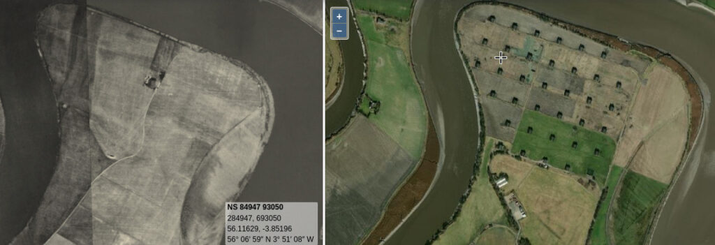
The image above is a screenshot of the Side-by-side maps on the National Library of Scotland mapping website. The image on the right is a modern-day satellite image. The image on the left is an aerial photograph taken by the RAF prior to 1950.
The location of this is the Bandeath Munitions Depot, located on the east coast of Scotland. This location was constructed prior to WWI and was in active use during WWI and WWII.
As you can see, the buildings and structures have been removed from the publicly available aerial images.
Related:
We created a video of the Bandeath Munitions Depot.